
Kyogle mayor Danielle Mulholland gives her opinion on the CSIRO flood mitigation report.
I’ve spent time reading the CSIRO flood mitigation report. This is a very comprehensive flood modelling undertaken for our catchment and models a range of hard infrastructure options aimed at reducing flood impacts, particularly for Lismore, upstream and downstream communities.
The scenario that achieved the greatest modelled reduction in flood levels (Bundle 2) includes 10 proposed dams at:
• Rock Valley – 94.3 Gigalitres (Lismore)
• Corndale – 91.3 GL (Lismore)
• Booyong – 82.8 GL (Byron/Lismore)
• Eden Creek – 69.4 GL ( Kyogle )
• Goolmangar – 53.9 GL (Lismore)
• Dunoon – 43.0 GL (Lismore)
• Bentley – 40.7 GL (Richmond Valley Council)
• Collins Valley – 39.5 GL (Collins Creek – Kyogle)
• Fawcetts – 39.2 GL (Fawcetts Creek, Fawcetts Plain, Kyogle)
• Barlings Creek – 11.3 GL (Kyogle)
(For comparison Rocky Creek Dam holds 14 gigalitres.)
Many people living in these communities may not yet be aware their locality has been identified as a potential dam site.
If you live in or near one of these areas, I strongly encourage everyone to take a close look at the report and attend one of the drop-in information sessions which are being held this week.
The report indicates that some of these dams could retain floodwater for up to two weeks before emptying. This makes it especially important that local communities understand what is being proposed and engage early in the process, particularly if, like me, you have concerns about the potential environmental, ecological or cultural impacts.
One of the questions I keep coming back to is:
How do we balance reducing flood impacts downstream with the deliberate temporary inundation of roads, farms, biodiversity and places of cultural significance in the upper catchment?
There are no easy answers, but I believe this conversation needs to include the voices of the communities who would be most directly affected.
This is a report with significant implications for communities across the Richmond River catchment.
Personally, I can’t understand how building billions of dollars worth of massive dams to lower the potential flood level in Lismore by 2m makes any economic sense.
What if the next major flood is bigger than the 2022 one?
Surely that’s just a matter of when not if. Surely the money, if it ever becomes available, would be much better spent moving people from flood prone areas to land that doesn’t ever flood thus permanently fixing the problem. 
The reality is that if you live on a floodplain, it’s sooner or later always going to flood.
And there’s one other consideration.
By 2050, which is not that far away, the federal government’s National Climate Risk Assessment estimates that up to 25% of homes will be uninsurable due to the increasing risks of climate change.
This means approximately one in every four houses across the country will lack adequate insurance protection, primarily due to soaring premiums Australian Prudential Regulation Authority (APRA).
The protection gap is already widening. While about 1.4 million homes are uninsured today, climate stress-tests conducted by the APRA indicate that around 40,000 additional homes will lose insurance coverage each and every year. 
Specific regional areas, like our region, face even harsher impacts; for instance, modelling from the Climate Council previously estimated that nearly 40% of houses in certain parts of regional Australia will be exposed to extreme weather threats like flooding, cyclones, and bushfires by the decade’s end and that just over four years away.
Imagine trying to get adequate and affordable home insurance living on a known flood plain after the impacts of the 2022 floods and future floods to come.
The next study is important.
That study will help us understand:
- if the basins can be built?
- how much they may cost?
- how much they may reduce flooding?
- which land and communities may be affected?
- are there any objections to the planned basins?
- what are these objections?
- will land be resumed for the construction of the basins?
- how much land will be resumed and will they be forced acquisitions?
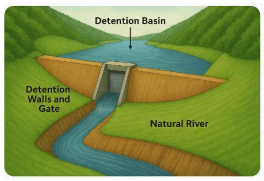
I understand that CSIRO were given a specific mandate but residents have contacted me about the report to find out where these detention basins are going in, what areas they will affect, where the maps can be found – a bit of transparent community engagement would be appropriate I think, complete with maps, so people know what is going on.
Furthermore, even with government backing, large scale infrastructure takes time.
Before earthworks can even begin, there are years of complex geotechnical analysis, environmental approvals, and land acquisitions required in the upper catchments.
When you factor in the sheer scale of the build and inevitable delays from our region’s weather systems, this would clearly be a multi-decade undertaking.