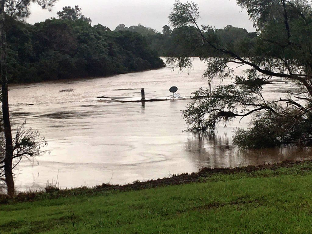
ABOVE: This house passed through Tuckurimba heading towards Coraki this afternoon. Photo: Kristy N Wes Suffolk
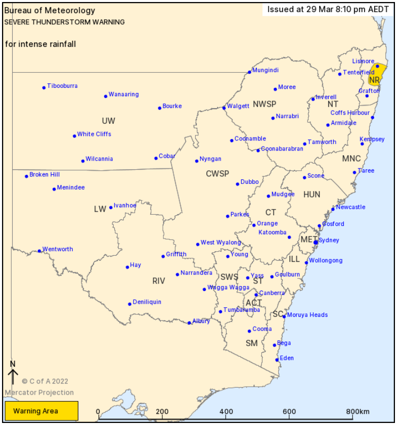
A stationary storm located between Maclean and Lismore is likely to produce intense rainfall tonight.
The Bureau of Meteorology issued a severe thunderstorm warning with intense rainfall caused by a developing low-pressure system off the northeast coast that is driving a moist and unstable airmass over the north east of NSW.

Locations which may be affected include Coraki, Evans Head, Woodburn, Wardell, Broadwater, Lismore, Ballina and Alstonville.
Evans Head has recorded 78mm in the last hour.
There is potential for more than 100mm of rain in an hour.
Flood Watches and Warnings are current for parts of northeast New South Wales. For more details, please visit www.bom.gov.au/nsw/warnings.
The State Emergency Service advises that people should:
- Keep clear of creeks and storm drains.
- Don’t walk, ride your bike or drive through flood water.
- If you are trapped by flash flooding, seek refuge in the highest available place and ring 000 if you need rescue.
- Be aware that run-off from rainfall in fire affected areas may behave differently and be more rapid. It may also contain debris such as ash, soil, trees and rocks.
- After bushfires, heavy rain and the loss of foliage can make the ground soft and heavy, leading to a greater chance of landslides.
- Unplug computers and appliances.
- Avoid using the phone during the storm.
- Stay indoors away from windows and keep children and pets indoors as well.
- Stay vigilant and monitor conditions. Note that the landscape may have changed following bushfires.
- For emergency help in floods and storms, ring the SES on 132 500.